Featuring over 2,000 stone arches, the aptly named Arches National Park was one of the highlights of our trip. A geological marvel formed over the course of 65 million years, the park’s sandstone formations must have an opening at least 3 feet wide to be considered an arch. This means that erosion can cause a formation to earn its official “arch” designation at any time, or that erosion can cause an arch to collapse, losing its designation.
In order to restrict the number of visitors and help alleviate overcrowding, Arches requires a time entry reservation between April and October. Reservations are released for purchase 3 months in advance. Since we visited on April 3, I bought our reservation online at the beginning of January. Note that the $2 timed reservation slot is a separate purchase from park entrance passes. Entrance passes ($30 per private vehicle) can also be purchased ahead of time online or in person when you arrive. Reservation times are one hour windows so there is no need to worry about arriving at an exact time. Note that there can be a backup to enter the park so make sure to account for time spent waiting in line. (There is a live webcam of the entrance station to help you judge how long the backup is prior to your arrival.)
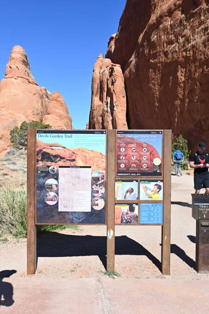
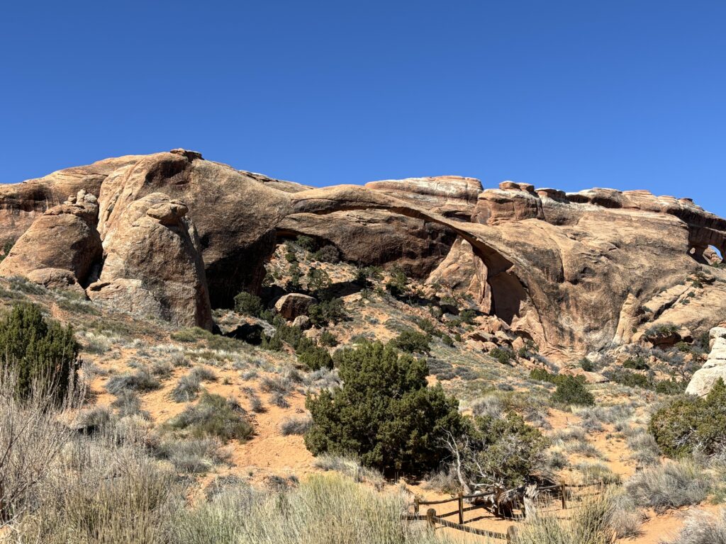
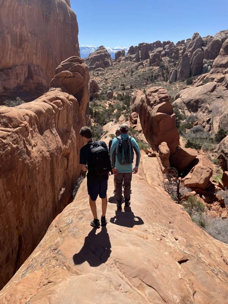
We were staying very close to the entrance to Arches and made it through the line and into the park shortly after the start of our 10 am window. Our plan was to head to the furthest point in the park and then make our way back. We went straight to Landscape Arch in the Devils Garden region of the park.
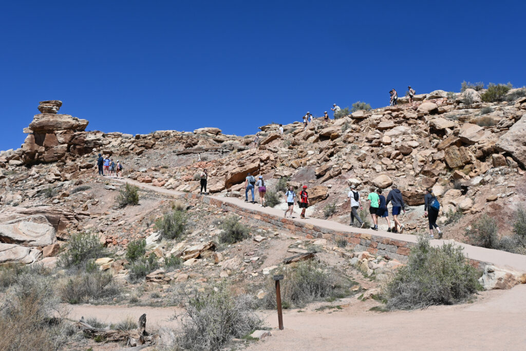
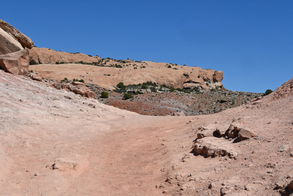
The trail to Landscape Arch is just under 2 miles roundtrip, although the trail continues beyond the arch so there is plenty of opportunity to lengthen the hike. The section that goes to Landscape Arch is an easy hike. It is a hard packed trail until the end where it gets a little sandy.
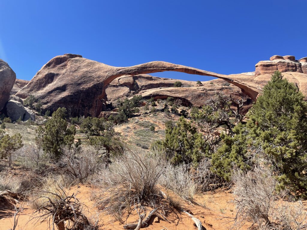
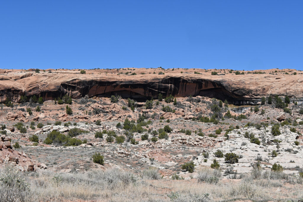
Landscape Arch is the longest arch in North America spanning 290 feet. The arch is dangerously thin in some sections, measuring only 6 feet in diameter at its narrowest spot. The trail used to pass right under the arch, but after two separate incidents of large pieces of the underside of the arch falling in the 1990s, that section of the trail was closed for safety reasons. Because the arch is in front of another rock formation, it’s difficult for photographs taken from the trail to capture the great expanse of the arch but it was truly impressive.
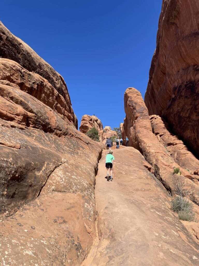
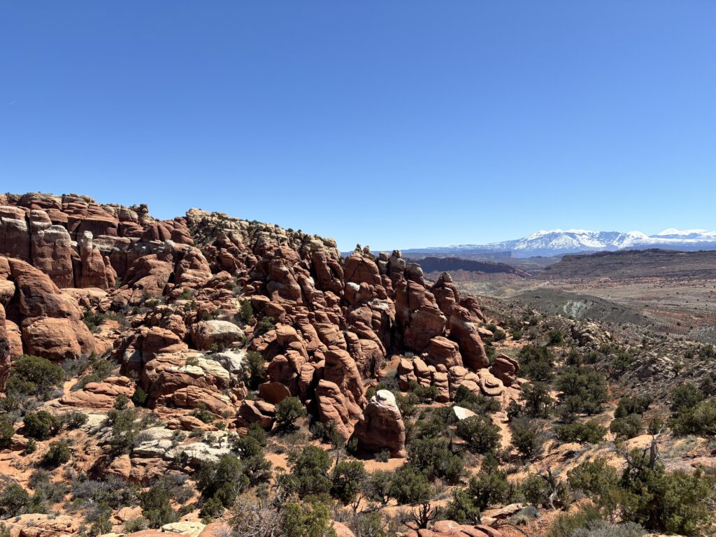
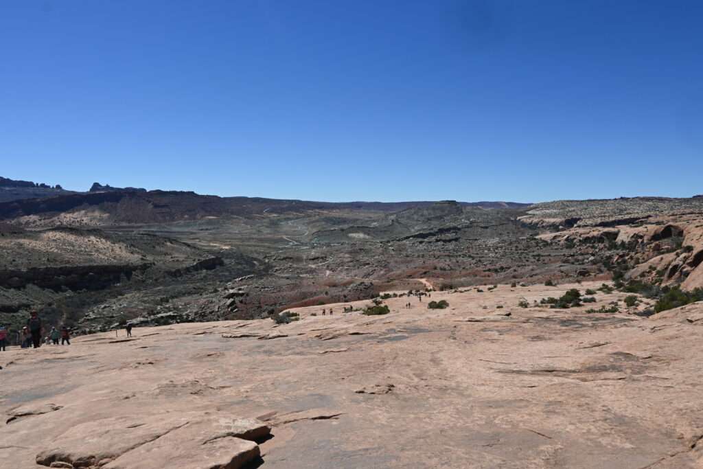
The trail continues beyond Landscape Arch but becomes much more difficult. Several in our group were interested in seeing the view from the top of the steep sandstone slab and made the trek to the top. As expected, the views were magnificent.
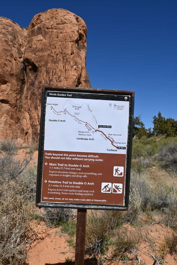
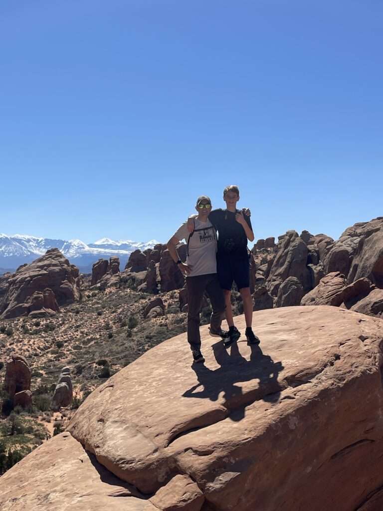
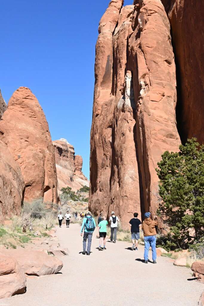
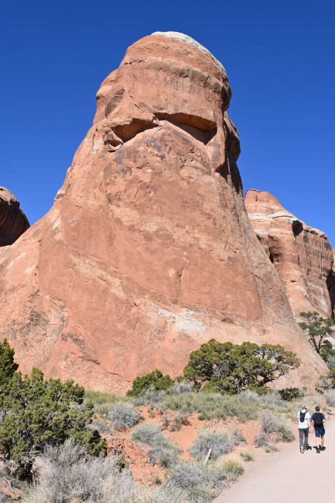
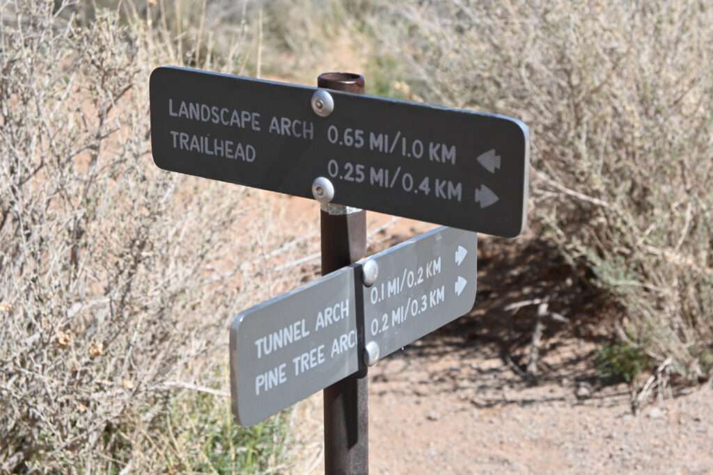
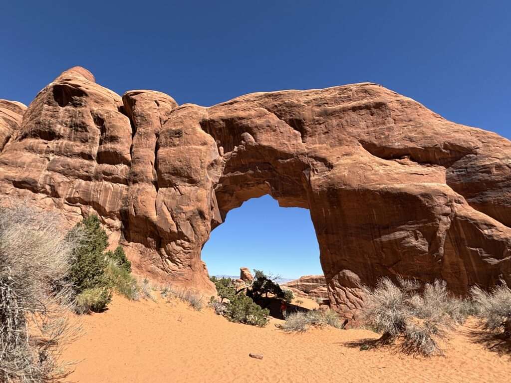
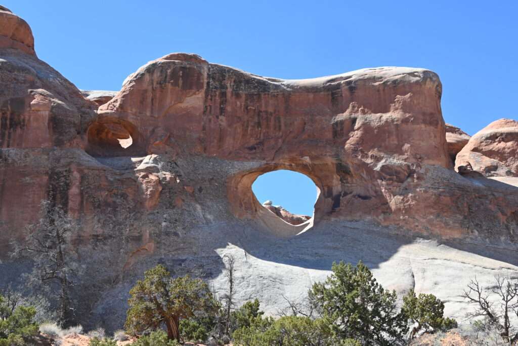
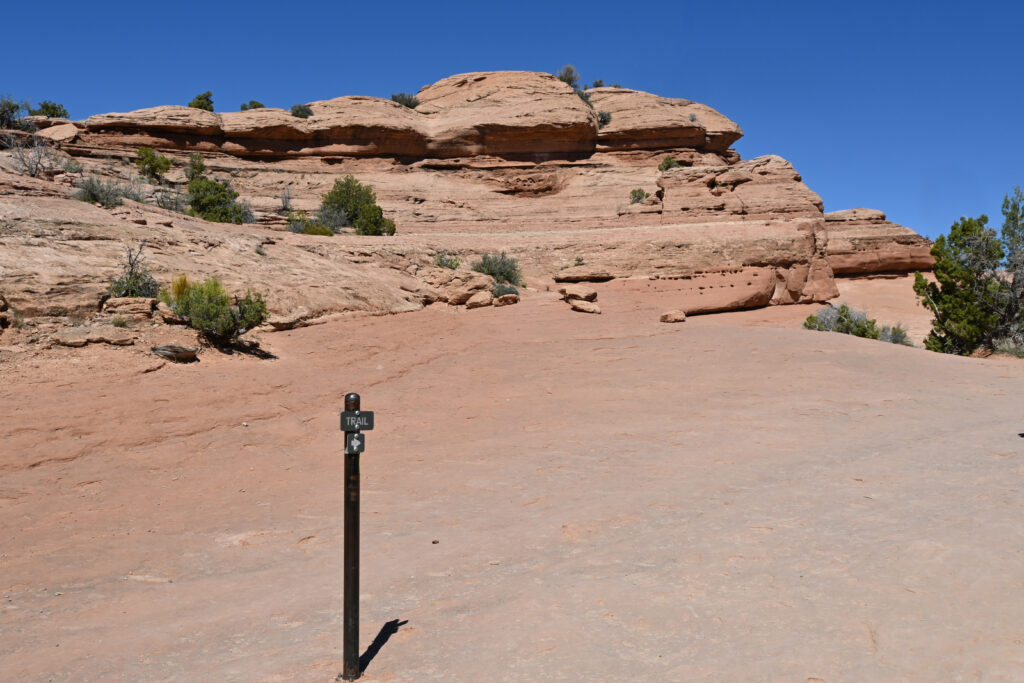
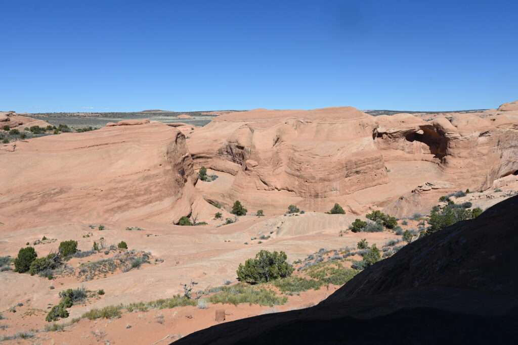
Once the explorers rejoined the rest of the group, we headed back to the parking lot. There is a spur trail that goes off the main trail and then forks and takes you to Pine Tree Arch and Tunnel Arch. They are worth checking out. The arches are below the main trail though, so of course that means that you have to hike back up. Several in our group that had just ventured up the rocks past the Landscape Arch chose to sit out this extra climb.
We all reunited at the top of the spur trail and hiked back to the parking lot. We left the Devil’s Garden area and headed towards the Fiery Furnace Overlook. The Fiery Furnace section of the park offers a very challenging hike that can only be completed with a ranger or with an individual permit. The ranger-led hikes start later in the spring so that option was not available to us. Individual permits are also difficult to obtain, but after reading about how physically demanding the hike is – and more importantly, how easy it is to get lost on the trail (described as a “natural labyrinth”) – we decided not to pursue that option either. So we took the easy alternative and viewed it from above. The overlook has its own parking lot and it only takes a minute or two to get to the lookout from there. The Fiery Furnace gets its name from the way the tall sandstone walls glow from the light at sunset. We were there around mid-afternoon so didn’t experience the magical lighting but the view of the tall stone towers was still beautiful.
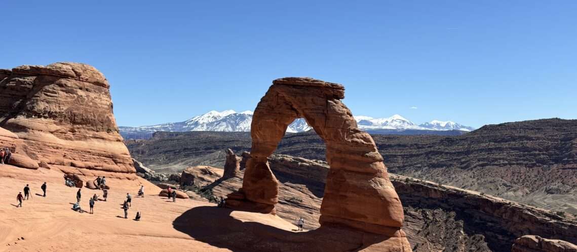
We stopped and ate lunch at some picnic tables at another overlook and then headed for the park’s main attraction – Delicate Arch. Well-known because it is featured on Utah’s license plate, this arch is difficult to get to but so worth the effort. The hike is about 3 miles roundtrip but has serious elevation gains and little to no shade, making it much harder than the “moderate” rating would have you believe. Many people underestimate the difficulty, the heat, or both, and ranger rescues are frequent on this trail.
From the parking lot, you walk past an historic cabin (which we visited on the way back) and cross a bridge before starting the switch backs on a sandy trail cutting through piles of rocks. Large rocks in the distance had streaks of desert varnish, a thin, hard coating of clay, iron and manganese oxides found on the surface of boulders.
Reaching the top of the switchbacks, we were greeted by the next leg of our journey – a giant expanse of slickrock. The rock was relatively flat side to side but a deceivingly difficult gradual uphill. The trail of people looked like ants on a hill.
This section of the trail felt the most difficult, both because of its gradual climb and because of the unrelenting sun exposure. We stopped for a quick rest next to some bushes (which only teased us with the possibility of shade) and looked back towards the parking lot to see how far we had come.
From here the trail became a little vague. Sporadic trail markers appeared, generically pointing across an expanse of rock. There were a few times where there was nobody else in sight when we briefly wondered if we were going the right way, but we continued on and eventually came to a narrow path that hugged a steep rock wall. We didn’t know what was waiting around the corner for us (more uphill climbs?) but we enjoyed the view over the edge of the cliff and marveled at / worried over the fact that so many young children were making this unprotected ascent.
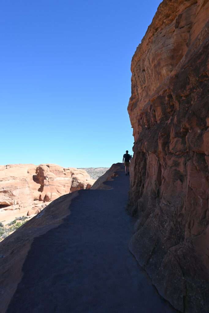
Finally we saw the top of the climb and a group of people sitting on top of some rocks. When we finally made it past the rock wall, an amazing scene opened up before us. Across a wide stretch of slickrock, Delicate Arch stood before us, its bright red colors popping against the green mountains directly behind it and the white, snow-capped mountains in the distance. It was truly a sight to behold.
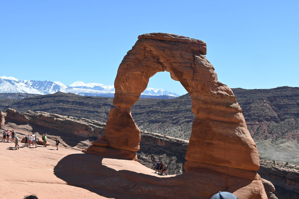
Delicate Arch is unique in both its size (52 feet tall) and the fact that it is freestanding. It seemingly emerges out of nowhere, a giant arch on an otherwise barren landscape. The route to get to the arch is heavily banked, as the whole area resembled a bowl, tilting somewhat perilously towards a steep drop-off into a ditch. Again I was shocked at the number of young children up here. It seemed like one wrong step could easily lead to someone tumbling down the embankment.

We sat on the outer edge of the rocks for quite a while, taking in the amazing scenery. It’s really difficult to describe how unique and beautiful it is. It is 100% worth the effort to get up there.
After resting, rehydrating, and appreciating the moment, we headed back down. From a cardiovascular perspective, going back down is much easier. But for someone who has had 7 knee surgeries, it was extremely challenging. I had to take small steps most of the way down to keep from putting too much pressure on it, and I felt like it took me longer to make the descent than the ascent.
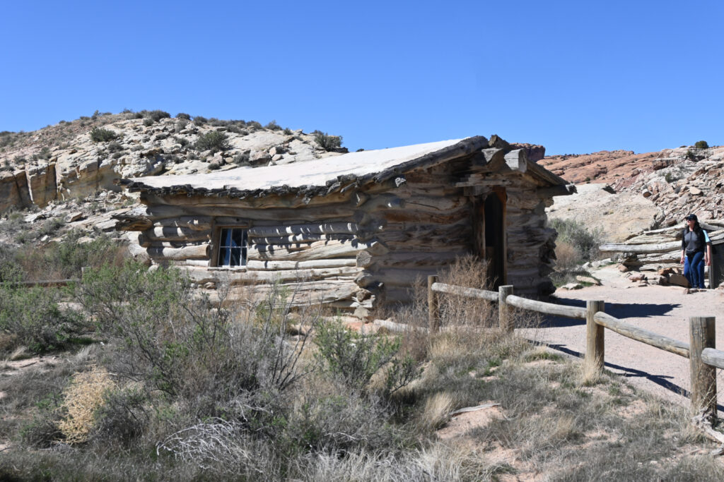
Before leaving, we walked around the little trail that led to the historic cabin. The one-room cabin at the base of the trail is known as Wolfe Ranch. In the late 1800s, John Wolfe and his son came to Utah to build a cattle ranch. Their original home was so basic that when the rest of his family arrived in 1906, they made him build a new home. This 17 x 15 foot single room cabin housed all six family members for four years before they sold it. The property changed hands two more times before it was sold to the US government so that it could be a part of Arches National Monument.
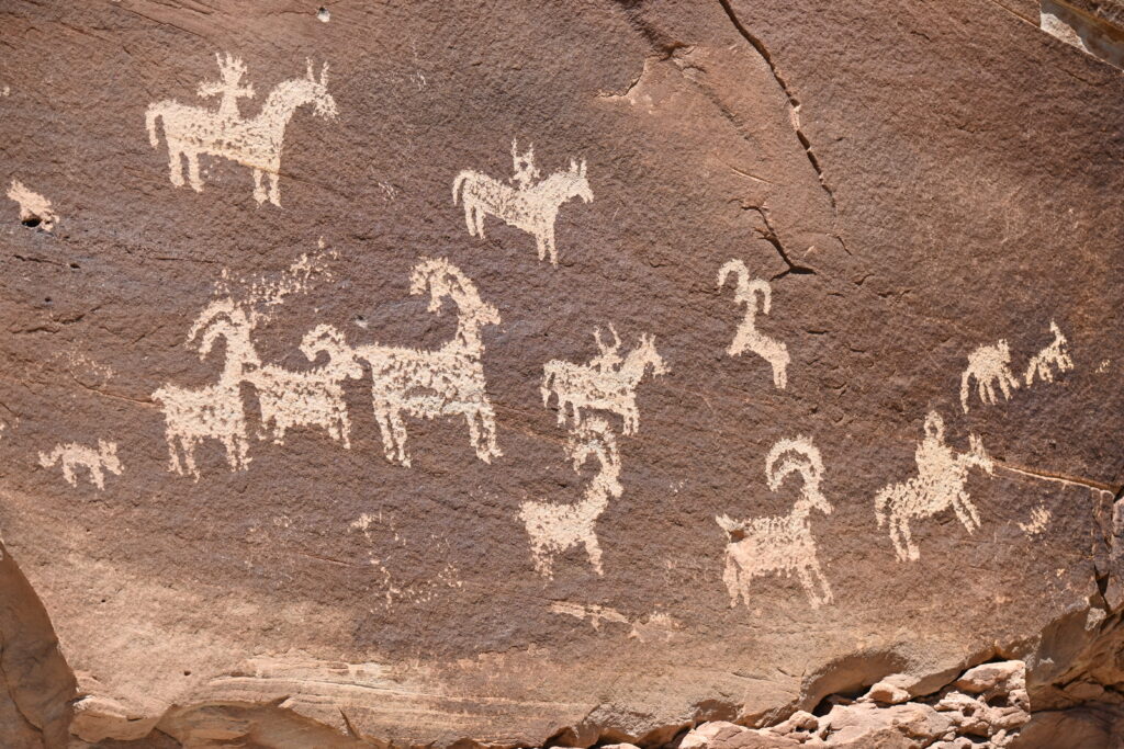
While a 118 year old cabin is certainly historically significant, it is a good bit younger than another historic site on the property. Just around the corner is a rock wall covered in petroglyphs. Scratched into the rock’s surface, this panel of art was created by the Ute Indians between 1650 and 1850. The art work features horses and riders (and their dog!) rounding up big horn sheep. It was a really interesting bonus to an already impressive experience along the Delicate Arch trail.
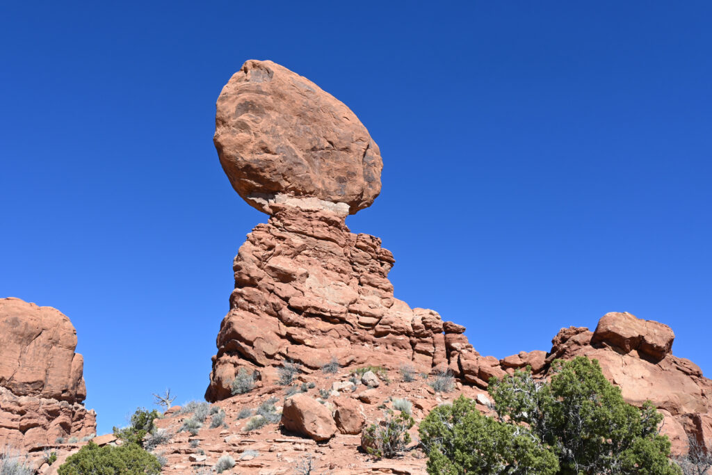
With two decent hikes under our belt for the day, we limited ourselves to one more side of the road stop on the way out. Standing 128 feet tall, Balanced Rock is an impressive gravity-defying display. A giant rock sits a top a mudstone pedestal that has eroded over the years to leave a thinning connection point. It will inevitably give way to gravity at some point, just as its (smaller) former neighbor, Chip-Off-the-Old-Block, did in 1975. Until then, it is worth the quick stop to admire its impressive balancing act.
Arches National Park was one of the places I was most excited to visit in Utah and it did not disappoint. It is awe-inspiring simply driving down the road in the park. With 2000 arches, dozens of hiking trails, and multiple scenic overlooks, there is no shortage of amazing sites in this park. From accessible viewpoints to challenging hikes, everyone can enjoy the unique scenery of southern Utah in Arches National Park.