On our first day of hiking, we followed Trail 2 (Sentiero Azzurro) from Monterosso to Vernazza and then on from Vernazza to Corniglia. The blue trail is the most well-known trail in Cinque Terre, as it hugs the coast and provides the beautiful views of the five towns that the area is famous for. The idea was to take a train back to Corniglia on our second day and pick up where we left off, hiking on to Manarola and Riomaggiore. But both those sections of the trail were not just closed; they were “really closed” according to the daily hiking update from our hotel. I guess if it is just a little bit closed you can enter at your own risk? Not sure but regardless, it was really closed (and had been for several years) and there would be no following of the blue trail past Corniglia on this trip.
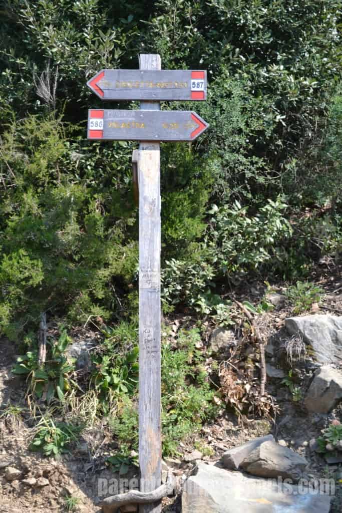
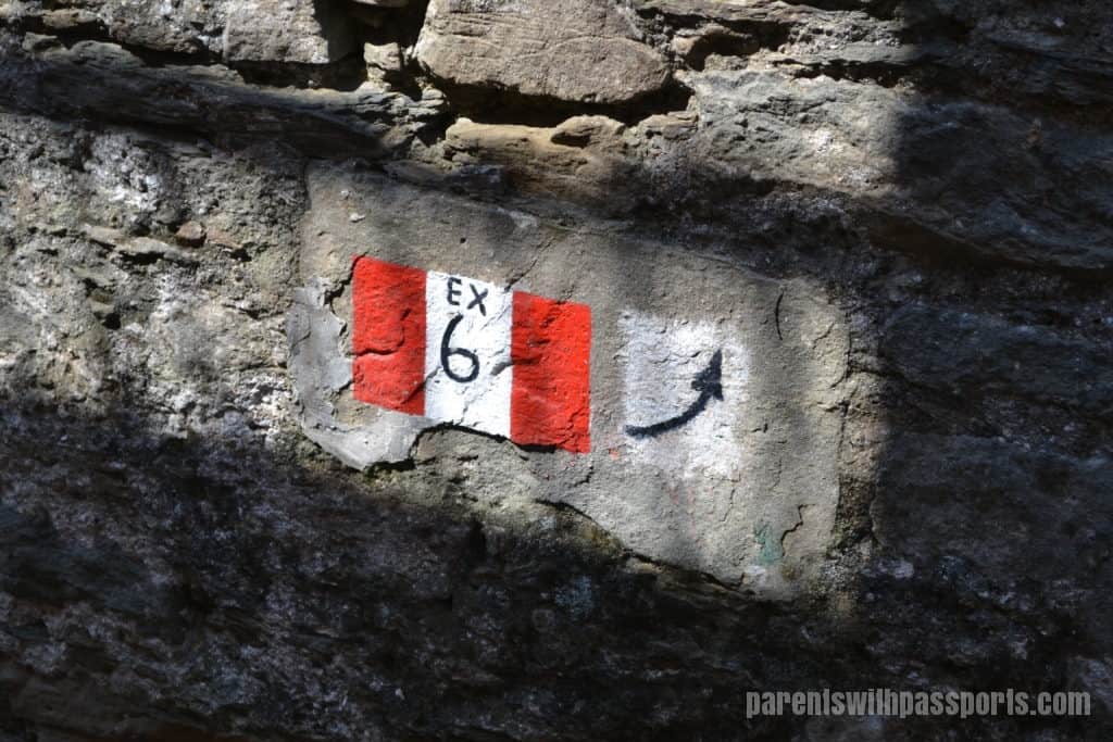
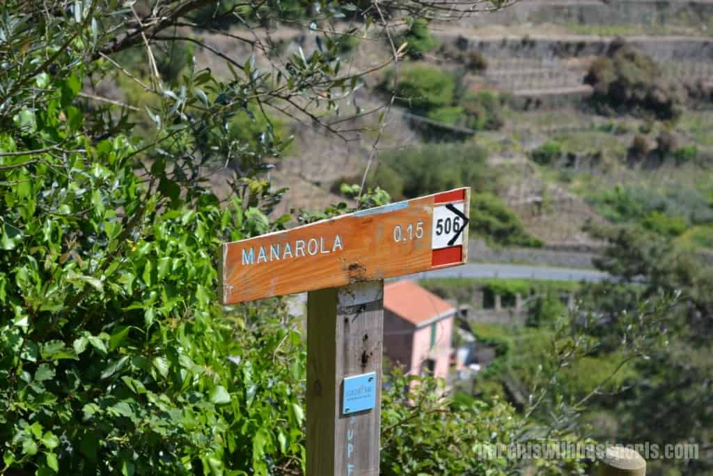
There is, however, a longer but beautiful trail that goes further inland through the town of Volastra and on to Manarola. Our hotel told us it was one of the most beautiful and scenic walks in Cinque Terre. They hadn’t let us down yet with their recommendations so we were happy to follow this one as well. I was a little stressed that there were 3 different trails that we would have to follow on the route (7A to 6D to 6) and worried that we might miss a trail marker. To complicate things, they had recently changed their trail numbering system so we were told some signs might still have the old numbers for trails 587, 586, and 506. Ugh. But we figured if we never got too far out of sight from the sea, we would be ok.
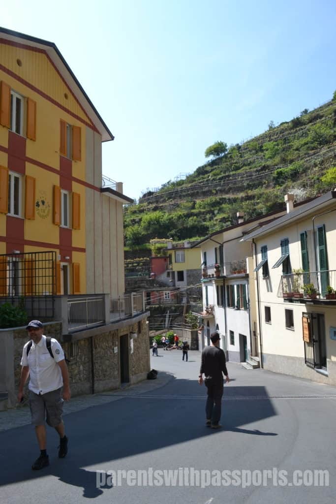
So we hopped on the train and headed to Corniglia. Of course, this meant the dreaded stairs from the train station again – this time going up. We just considered it a warm-up for what was to come.
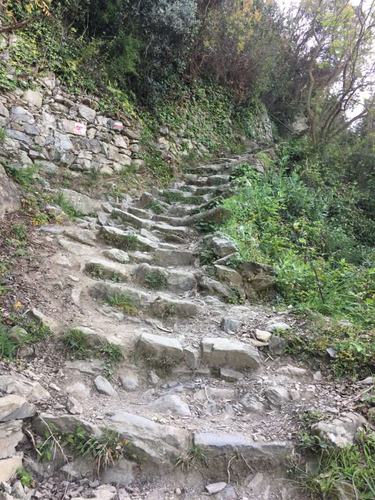
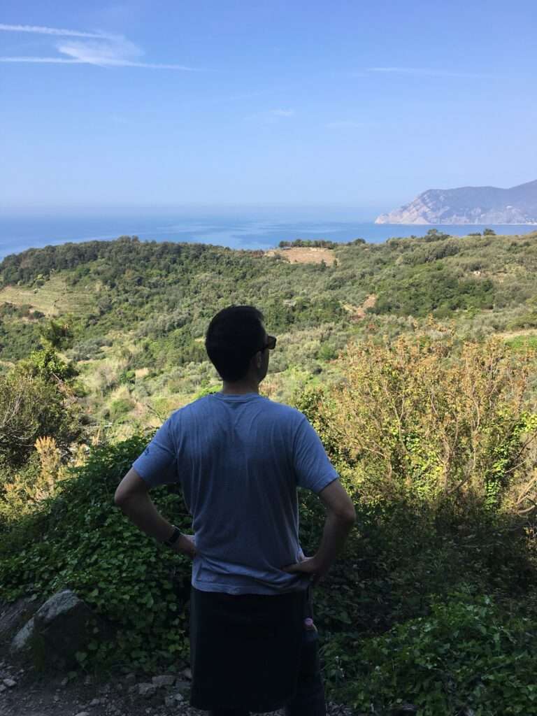
As per usual, the path started off with stairs and seemed to go straight up for at least half an hour. Somehow the stairs on this hike seemed more dangerous than the others. Angled steps with loose rocks and sheer drop-offs with no handrail for protection were the norm. It was strange to be hiking away from the coast instead of along it. With our backs to the water, we climbed further and further into the hills. The landscape was more forest-like in this area and we were surrounded by lush greenery in all directions.
Our first trail marker confirmed my fears – they had the old numbers! But as long as they had the names of the towns on them too, we could be confident we were headed in the right direction. Soon Corniglia was becoming a distant memory behind us.
Although the signs confirmed that we were on the trail and headed in the right direction, there were times I felt certain that we couldn’t possibly be on course. The trail at one point literally cut through someone’s backyard. Their house was close enough to touch on our lefthand side and their beautiful yard was on the right. They even had a soccer goal set up, perhaps in case some hikers wanted to challenge them to a match.
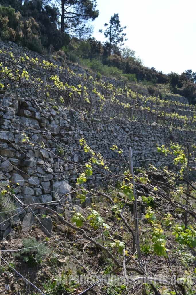
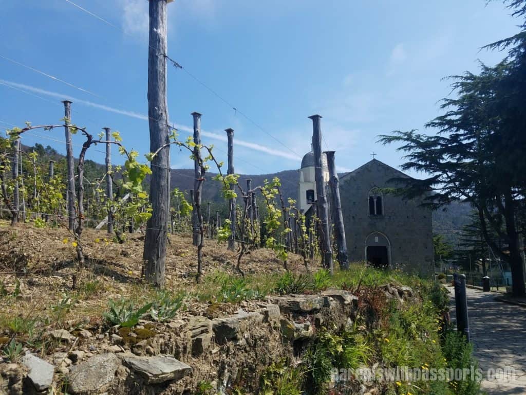
But there had been no forks in the path since the last marker so we knew we had to be on the right trail. We snuck guilty across their yard and continued on the trail around their house. When the trail opened up again around a bend, we were amazed at the rows and rows of stunning terraced vineyards that lay before us.
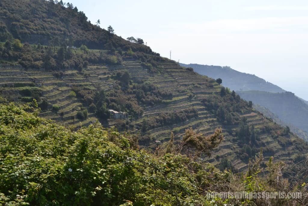
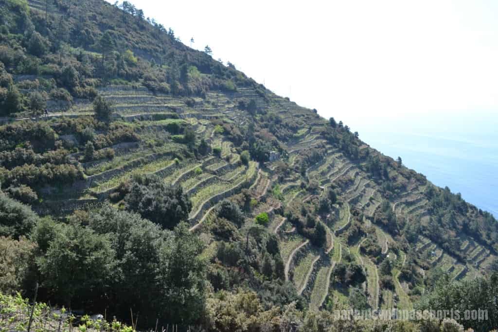
The trail cut across the terraces so we were able to walk right through the vineyards. I’m not sure which was more impressive – the fact that they had built the dry stone wall terraces into the side of the mountain or the fact that they successfully maintained the crops on this terrain. The amount of work it must take to water, tend to, and harvest the grapes is stunning.
We had seen terraced vineyards on previous hikes (although nothing of this magnitude) and kept seeing a metal track about three feet off the ground that climbed up the mountain. We weren’t sure what they were but guessed that they were some sort of irrigation system. Turns out they are monorail tracks! We were so excited when we finally saw a little train (trenino) climbing up the mountain on the tracks. It made perfect sense – the trains could carry tools, stones, grapes, even people up and down the hills, vastly increasing efficiency and decreasing exhaustion from manual labor.
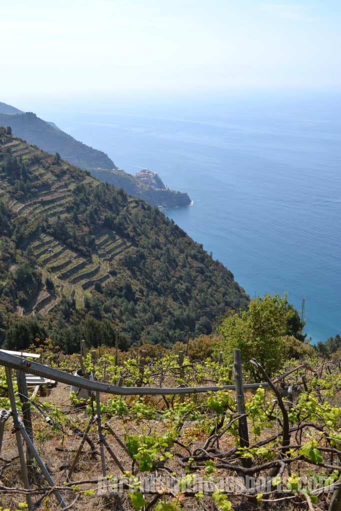
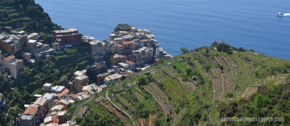
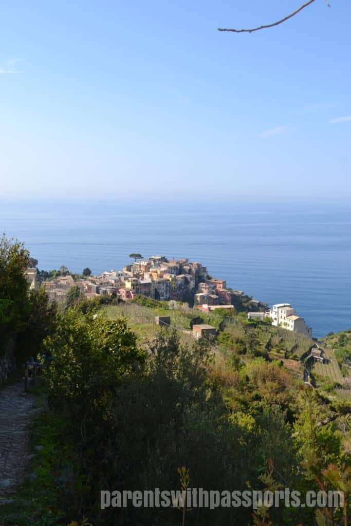
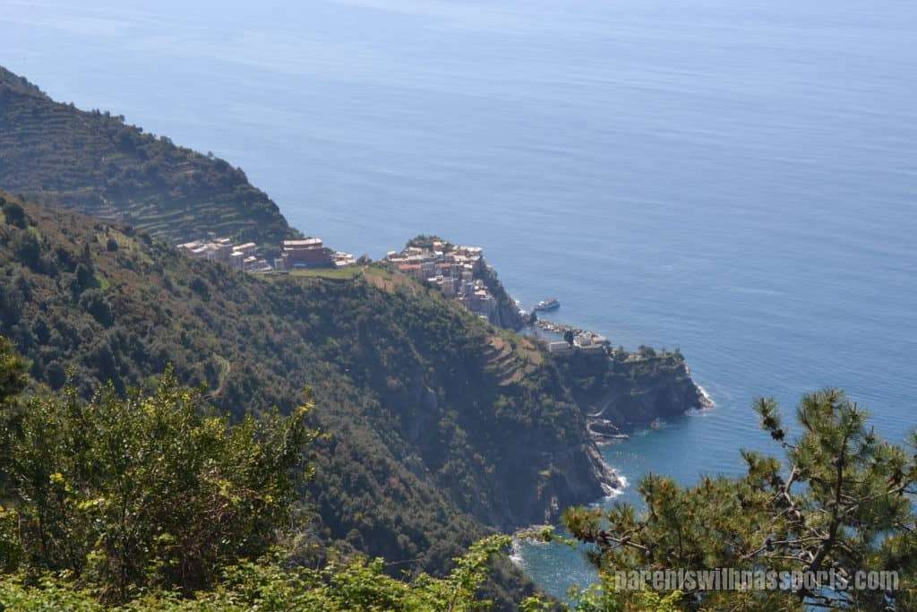
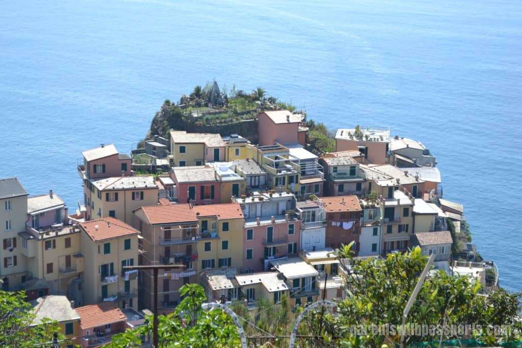
We continued to make our way across the vineyards (thankfully not up and down!) and turned around to get a beautiful view of Corniglia. This view struck me for two reasons. One, you can see how very high the cliff the town is built upon is and what a steep drop-off there is. Even in the land where colorful buildings seem to defy gravity, you can understand why there was no opportunity to build into and down the hill in Corniglia. And two, you can get a sense of how far below town the train station is (hence all those steps!) and how amazing it is that the train tunnel goes literally straight through the mountainside.
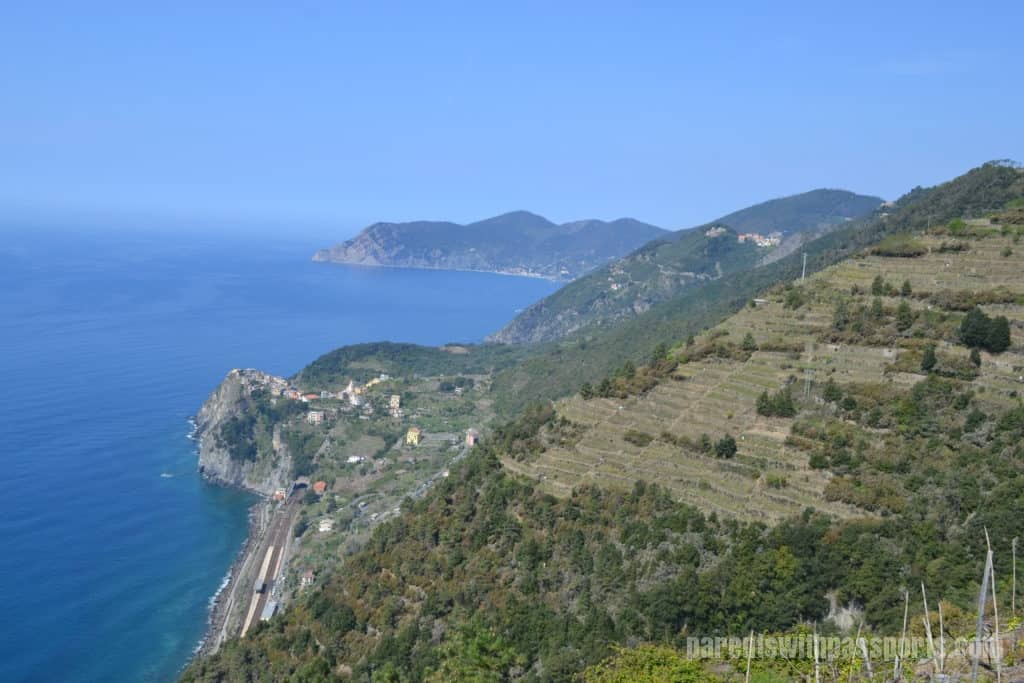
And of course, after looking back on where you’ve been, you can turn around and see where you are headed. Manarola was still a good ways ahead but getting closer.
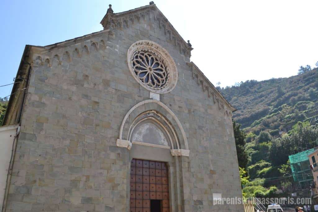
After making our way across all of the vineyards, we came to the town of Volastra. The path and vineyards end right in front of a beautiful old church, Nostra Signora della Salute.
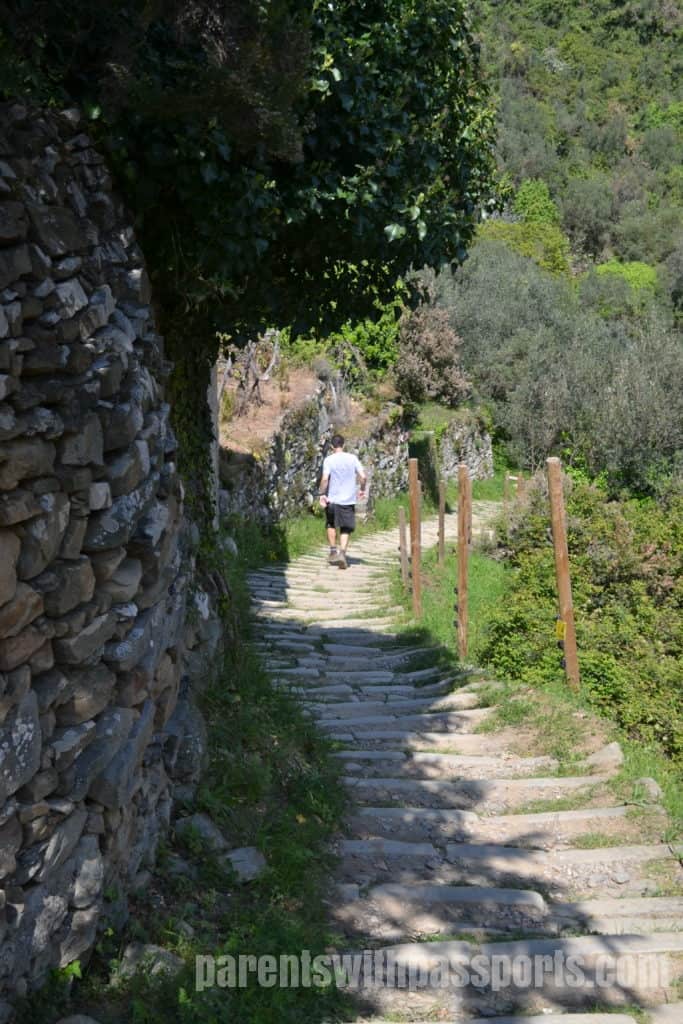
From here, it was a downhill hike to get to Manarola. But beware of the conflicting signs. Same trail, different numbers.
This downhill section was extremely awkward for me. The steps were shallow and oddly spaced so that at times it seemed easier to allow gravity to make you almost run down the hill. It seemed like either steeper steps or no steps at all would have been more natural.
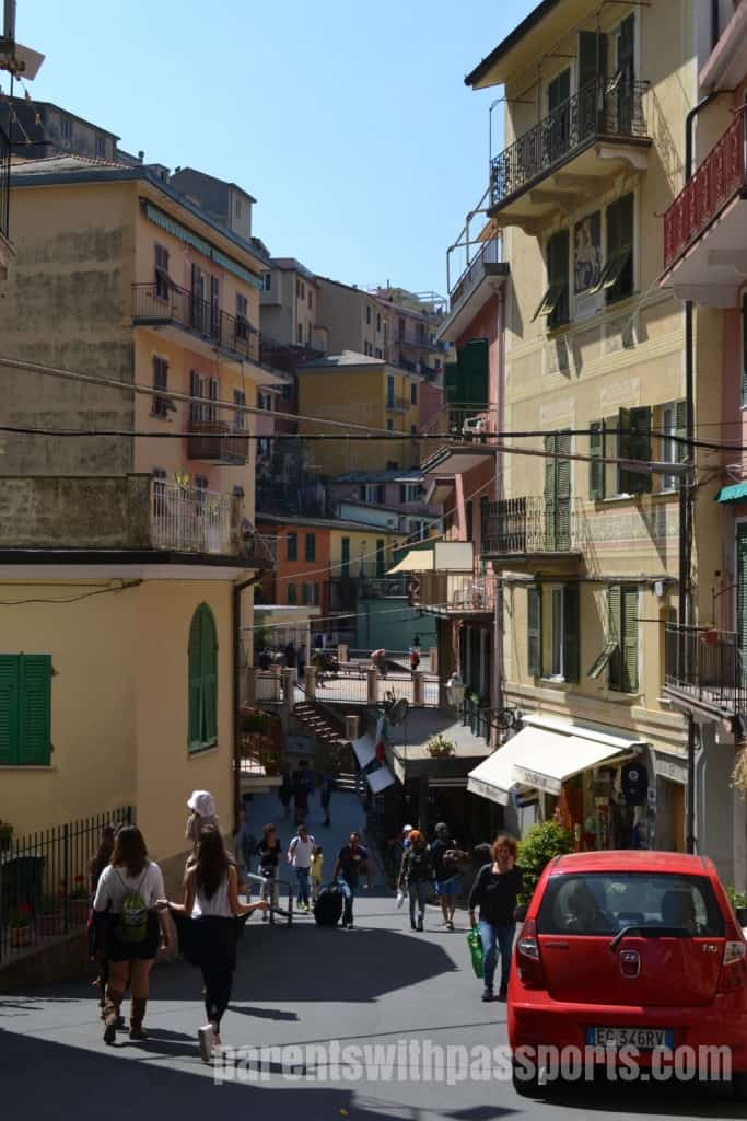
We made our final approach into Manarola. Part of the city was perched on the cliff overlooking the water and part was uphill from there and built into the terraces.
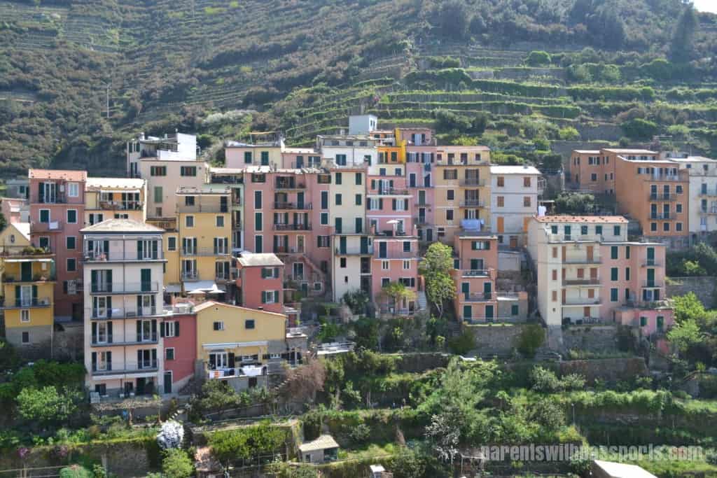
We entered the town at its highest point, in a square that was home to both the town’s church and bell tower. Manarola seemed to have both the widest and the longest main road. In this top section especially, it didn’t feel quite as claustrophobic as the other towns with their narrow alleyways.
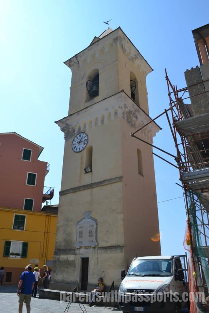
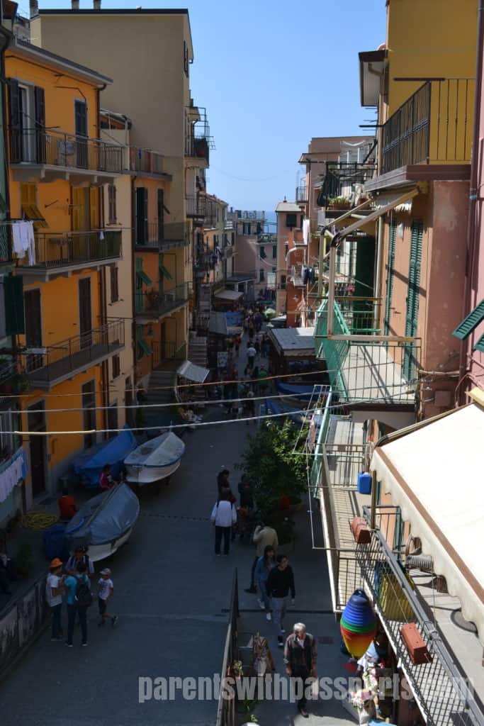
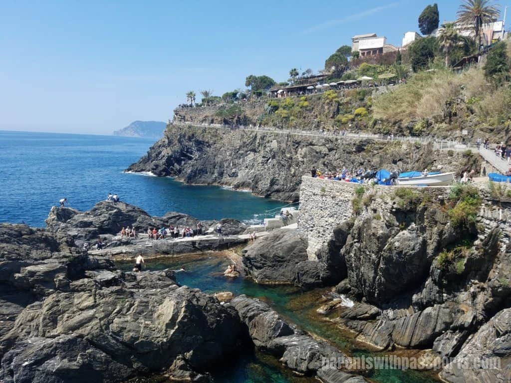
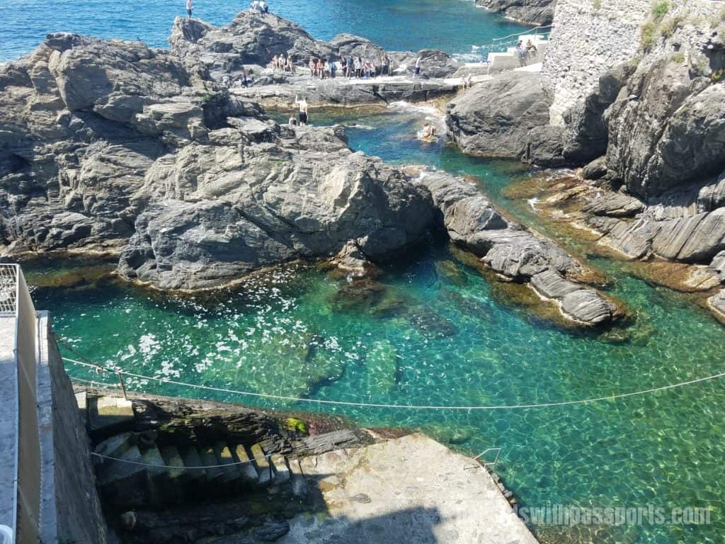
Apparently the train tracks used to run straight through town, so an elevated square, Piazza Capellini was built. Covering the railway lines, the piazza adds an element of safety and a noise barrier. It also divides the main street into an upper and lower section. In the lower section, the street narrows more and boats line the side of the street. When you finally reach the bottom, you find the town’s deep swimming hole.
We stopped for lunch at the cafe part of Ristorante di Aristide. We enjoyed people watching from the outdoor seating area but found the service and food to be just ok. Regardless, we celebrated finishing our longest hike yet and plotted what to do next. The final leg to Riomaggiore should be the easiest, walking around the cliff along Via dell’Amore. But a rockslide in 2012 closed that trail indefinitely. If we wanted to complete the hike through all 5 Cinque Terre towns, we would have to go up and over to get to Riomaggiore.